With its rolling hills and expansive valleys, a drive through Scott County brings forth visions of simpler times. Adding to that vision are the numerous swinging bridges that span rivers and creeks throughout the county. Once used as a primary mode for foot transportation, today the bridges serve as a reminder of life removed from today. The brooding colors of old bridges are the very stuff of soulful memories and are worth seeking out as you drive around Scott County.
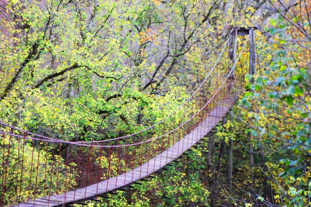
Swinging bridges are historical pedestrian bridges towering above rivers and creeks. During floods, the bridges were often the only means to cross the waterways. These suspension bridges are often called swinging bridges because the bridge sways beneath your feet as you walk across. They are also referred to as rope bridges due to their historical origin based on the ancient Inca rope bridge.
The bridges were constructed in such a way that they spanned the river without the need for foundation pillars in the middle that could possibly obstruct river traffic. Typical construction would start with a ball of twine to judge the curve and distance. Upright piers were constructed first before being pulled into position by men in boats or on horses or mules. The cable was then dragged across by hand using a wheel or pulley.
Many of the swinging bridges in Scott County were constructed and maintained today by the Virginia Department of Transportation (VDOT). Several though were obviously constructed by locals from whatever material lying around on the farm. One of the best examples of this is the now defunct wooden bridge at the end of Mail Drop Lane. Covered today in honeysuckle and kudzu, this bridge is a testament to the ingenuity and resourcefulness of the people of Scott County.
Grab your camera and tighten up those nerves because a walk onto a swinging bridge for first timers can be a little intimidating. Be prepared to feel the sway beneath your feet, and if someone is behind you, the bobbing up and down of the bridge. With bridges constructed high above the river, a full crossing might prove daunting for those with a fear of heights. Don’t worry, swinging bridges are perfectly safe and offer a great view of the river below.
Anglers Way Road—This is one of the easiest bridges for public access. From Hwy. 23/58N, turn left onto Angler’s Way Road. Follow Angler’s Way for six miles. You may pull alongside the bridge and park. The bridge crosses private property but is maintained by and open to the public. It may also be accessed on the other side via Waters Edge Road.
Clinch River Highway—Take Hwy. 23/58N and turn right onto Clinch River Highway. The bridge is located just past the railroad trestle at the corner of Bridge Street and Dewey Avenue. Public access allowed and maintained by VDOT.
Clinch River Highway—Closed to the public. Located across from Clinchport Freewill Baptist Church.
Mail Drop Lane—Turn right off Veteran’s Memorial Highway onto Mail Drop Lane. Go to the end of the road to the railroad tracks. Look left and there stands the bridge, which is covered in kudzu.
Moore Hollow Lane—Located on Veteran’s Memorial Highway, across from Moore Hollow Lane. You have to cross the railroad tracks to access this unmaintained bridge.
Holston River, Route 614, off Wadlow Gap Road—Crossing at the Holston near the area Daniel Boone forded the river to blaze the Wilderness Trail. Boone and his companions gathered at the original John Anderson Blockhouse, which was located on property on what is now East Carter’s Valley Road.
Copper Creek—Near the intersection of Routes 643 and 627. Best access is from Manville Road from Gate City. Additional private bridges are located down this road.
Copper Creek—Take Addington Frame Road and turn onto Ponderosa Lane. Swinging bridge is located next to the low river bridge.
Copper Creek—This bridge can be accessed either by driving to the end of Copper Creek or by taking Hwy. 23/58N and turning right onto Copper Creek. Follow the road to Double Ford Road, (you have to ford the creek twice here). Not advisable to cross Copper Creek when water is running high.
Big Moccasin Creek—Located behind Gate City Christian Church on Old Nickelsville Highway.
North Fork of Clinch—Located at the end of Addington Ford, Route 621. From Highway 23/58N, turn left onto Fairview, Route 600. Travel approximately seven miles to Addington Ford, turn left and travel down the dirt road.
Copper Creek and the Clinch River Highway and Veteran’s Memorial Highway provide access to the majority of the bridges.